Map search guidance and helpful hints
To get the most out of using the map search interface please read through this guidance which will help to shorten your workflow, guide you toward finding results quickly and make you aware of caveats in the mapped data.
By default the link at http://db.poms.ac.uk/map/browse/ will display a large map of Scotland with a bare earth terrain backdrop.
Different map backgrounds and overlays can be selected by using the layer switcher which you can find in the top right of the map window.
Hovering over the icon will show a selection of backdrops and overlays:

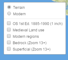
The Modern option displays a modern map background derived with transport an urban areas, which may be useful for navigating the map.
Additionally, you are able to view modern regional divisions and see a summary of medieval land use areas. Courtesy of the National Library of Scotland, we are able to provide an early Ordnance Survey map, derived from surveys that took place between 1885 and 1900. Users should be aware that the accuracy of this map when viewed over modern map data may be varied, however given the regional nature of much of the spatial information recorded in PoMS it was felt that this map may provide valuable contextual information.
At zoom levels of 13 or above, geological information is also available. Clicking on the map when geology is visible will retrieve information about the lithology of the region.

There are two ways to zoom into an area on the map. You may either use the Zoom control in the top left (a) of the map or by holding down the shift key and dragging a rectangle shape on the map, you can zoom very quickly to a specific area (b).
a b
b

To search for regional information, you can either specify a county from the selection in the bottom left of the map, or draw a rectangular search area using the black square tool seen in the image above.

When you have drawn a search area, places found within that area will be displayed.
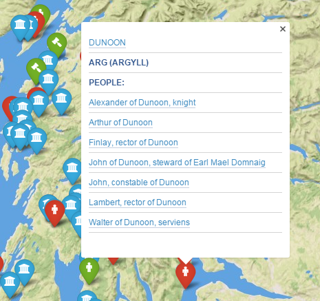
The icons drawn on the map reflect the nature of the information recorded about that place, and clicking on a map icon will trigger a popup window with further information and links to source material.